Monday 9 November 2015

Riverside Rat-Running Reduced


[Any of the images can be clicked to enlarge.]


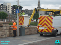
A Toucan Crossing has been installed at the far end of Ness Bridge in Inverness. It links and aligns with Huntly Street and Ness Walk to provide pedestrians with a straight route along the riverside. The junction has been painted with a yellow box. There are dropped kerbs all around the junction apart from, puzzlingly, one kerb on Young Street.


The main traffic is in four lanes between the Ness Bridge (city centre side) and Young Street (leading to the main road to Fort William). The side roads (Ness Walk and Huntly Street) are both one-way (away from the camera). When this (first) phase has a green light any traffic from Huntly Street is stopped but there may be some traffic turning into Ness Walk from either direction. So this is a safe time to cross Huntly Street although there is no signal for pedestrians.


On the second phase, the main traffic is stopped allowing traffic from Huntly Street to cross to Ness Walk or turn right into Young Street. Turning left from Huntly Street onto Ness Bridge is explicitly prohibited. This was done on purpose to deter rat-running along Huntly Street into the city centre.Also in this phase, pedestrians can cross all 4 lanes of the Toucan Crossing.


When the Green Man appears on the Toucan Crossing the audible signal can be heard by any pedestrian heading towards Young Street. This can give the false impression that it is safe to cross Huntly Street (and possibly Ness Walk) when actually traffic from Huntly Street has been given a Green Light.


Pedestrians (particularly visitors) using the Toucan Crossing may wrongly assume that a Green Man means that ALL traffic has been stopped and that it is safe to cross diagonally by the yellow box. As a result they may unwittingly put themselves in front of cars from Huntly Street.


Even if they keep within the crossing they might need to watch for traffic illegally turning left onto Ness Bridge.


Up to this point I haven't mentioned cyclists although it is a Toucan Crossing. As is often the case the Highland Council have left it for cyclists to determine their own routes and negotiate with other road users. Many cyclists will stay on the road. I understood that the original intention was to provide a small lane to allow cyclists to turn left from Huntly Street. There is no signage to indicate this. In practice, I suppose this could be the route I've indicated across the blister paving but that would be so wrong.


There is an exception that allows contra-flow cycling along the full length of Huntly Street. How this is intended to work at this junction remains a mystery. It is clearly legal to cycle across the Toucan Crossing except that the pavement at each end has not been designated for cycling (or shared use). Again, it might be legal to cycle across the corner - but not advisable. The Toucan Crossing will encourage (illegal) pavement cycling. This photo also shows that it's not uncommon for drivers to stop their vehicle on the crossing and/or the yellow box.


Summary
The goal of reducing rat-running along Huntly Street seems to be a success. However this depends on drivers being responsible and the law being enforced on drivers who don't comply.

Drivers on Young Street need to take care that there will be enough space beyond the Toucan Crossing so that their vehicle will not end up blocking the crossing and/or the yellow box.

Pedestrians can cross Young Street with the help of a central refuge. It's odd that there is a dropped kerb on one pavement but not the opposite one. There are no pedestrian signals here.

Crossing Ness Walk, particularly from Ness Bridge, can be difficult. There is always the potential for traffic to enter Ness Walk from any of three different direction at different times.

There is a safe phase to cross Huntly Street but there is potential for confusion.

The inclusion of a phase that allows pedestrians and cyclists to cross the junction in all directions, including diagonally, might be safer. Or expressing it in a different way, extend the Toucan phase to the whole juction and give Huntly Street a phase of its own.


Your comments are welcome.

Monday 29 June 2015

Huntly Street Uncovered


[Any of the images can be clicked to enlarge.]

Last week's blog A Pavement with Aspiration described the problem for cyclists and pedestrians caused by parked vehicles on the newly opened shared-path on Huntly Street.


At a meeting convened by HITRANS, on Wednesday, The Highland Council (THC) informed Highland Cycle Campaign (HCC) that repeater 'No Waiting' signs had been ordered to inform drivers and support Traffic Wardens.


On Friday morning the signs were being fitted. Apart from two marked bays for disabled parking and for loading it should now be clear that there is no waiting anywhere between Greig Street Bridge and Ness Bridge.


It took a while for already parked vehicles to move away but by the evening the street was clear revealing a very pleasant environment.

This was helped by the presence of  'No Waiting' cones along the pavement. It turned out that these were not intended as a permanent feature but to ensure that the area was kept clear for a Riverside Party on Saturday.


Perversely, the opening of Huntly Street was to be celebrated by a party that required the street to be closed.


Two friends of Big Rory were on duty entertaining people and diverting the traffic.


The weather held and children had a great time on attractions including the Eurofighter, Bouncy Castles and Merry-go-round.


The area still looked good on Sunday but the real test starts on Monday. But hopefully by then Traffic Wardens will be patrolling to enforce the parking restrictions.
Truly a case of watch this space - literally.

Your comments are welcome.


Friday 19 June 2015

A Pavement with Aspiration


[Any of the images can be clicked to enlarge.]

HITRANS is one of seven Regional Transport Partnerships in Scotland
which were established through the 2005 Transport (Scotland) Act.


Last week (11 Jun 2015) they published a good news Press Release for Bike Week.
http://www.hitrans.org.uk/News/Story/157

It included a publicity picture of three commuter cyclists.

The chosen location was the newly opened Huntly Street with Inverness Castle in the background and the River Ness out of sight on the other side of the flood wall.


A few days later, the Press and Journal ran an inspiring story based on the Press Release.
Cycle friendly Inverness tops cycle to work poll

Their caption for the picture referred to "... the new cycle friendly lane on Huntly Street ..."
My immediate thought was "If it's so cycle friendly, why are they all wearing helmets?"
I know that each of these has their own reason but it's just not that typical of local cyclists.

But a "new cycle friendly lane" is always worth taking a looking at.


This photo is a zoomed-out view at the same location.

The triangles represent the approximate position of the cyclists on an unsegregated shared-use pavement with a Caithness slate surface.

The tarred road is one-way in the direction of view. There is a narrower path on the side where I was standing.

In the distance, a yellow digger is completing some final work on the wall.


Huntly Street is a Restricted Parking Zone. Although there are no single or double yellow lines, parking should only be in designated bays. The pavement, as shown here, has a dropped kerb flush with the roadway and is not designated for loading or parking.


I took my photo in late morning and was lucky to catch a moment when the pavement was clear.
Usually there are cars on the riverside pavement. And they're not just partly on the pavement but in the middle of the pavement.


This next photo was taken later in the day and a bit further back.

A shot like this with 9 parked vehicles is much easier to take.

Notice that the pedestrians are on the narrower pavement.


This is not surprising really when you see the view looking back from roughly where the cyclists were pictured.

The question whether this pavement is "cycle friendly" is currently irrelevant.

Sadly, this pavement is not even pedestrian friendly.


Some motorists believe pavement parking is allowed because of the lack of yellow lines.
The pavement being at the same level as the road encourages this idea.
Once one driver parks, others are quick to follow.

What can be done to return the pavement to its intended use?

- Traffic Wardens could advise drivers who attempt to park.
But this would be a full-time job and (as far as I know) the Highlands only has two Traffic Wardens.


- Fix 'No Waiting - At any time' plates to appropriate lamp standards. It is accepted that there is a desire to reduce street sign clutter. But drivers have been observed looking at lamp standards to see if there are any parking restrictions. This would provide a reference for the avoidance of dispute.


- Place temporary traffic barriers along the kerb. They don't need to be joined together. Just enough to indicate that this is a pavement and is not intended for vehicles. Temporary fencing has been put in place near Friars Bridge to protect the new grass. Surely people are no less important than grass.


First we need to be able to use the pavement - then we can consider how friendly it is.

Your comments are welcome.

Thursday 21 May 2015

A Trip down King Street


[Any of the images can be clicked to enlarge.]

Last month, Highland Cycle Campaign organised a presentation with guest speaker Chris Thompson from Living Streets.

The subject of 20's Plenty was inspired by a recent earlier meeting with Rod King MBE.

As I would be doing an introduction, I decided to familiarise myself with some of the 20 mph streets around Inverness.


There are significant examples of good practice in Inverness but I found one area particularly confusing.

Kenneth Street is on the A82 Trunk Road linking Inverness to Glasgow through Fort William. Kenneth Street is 30 mph but the streets between it and the River Ness are all 20 mph.

The route of interest starts at Junction A.


Junction A

King Street is one-way with its speed limit clearly signed as 20 mph from the junction.

Let's proceed along King Street to the next main crossroad.


Junction B

This is the junction of King Street with Greig Street.

Just before the junction there is a pair of 30 mph signs. On the other side of the junction there is a pair of 20 mph signs.

This would seem to imply that Greig Street, the street we're crossing must be 30 mph.


Junction C

But if we take a short detour to the Kenneth Street end of Greig Street we can see that Greig Street is actually signed (correctly) as 20 mph.

So the 30 mph signs at Junction B are wrong.


Junction D

Continuing a little further along King Street, we come to the junction with Balnain Street.

It is signed as 30 mph from the start but is signed again as 20 mph from half-way along.

The resulting short 30 mph length makes no sense.


Junction E

Next we come to Queen Street which is 20 mph and has 20 mph signs just before it meets Huntly Street.

Huntly Street runs along the west bank of the River Ness and is currently closed for the Flood Alleviation Scheme.

When re-opened it will (still) be 20 mph.


Junction F

At its far end, King Street forks into two streets that both make a junction with Celt Street.

The street on the right, Duff Street, has a pair of 30 mph signs just before Celt Street.


Junction G

The street on the left branch, Muirtown Street, similarly has a pair 30 mph signs where it crosses Celt Street.

But Celt Street is 20 mph.

So the 30 mph signs at Junctions F and G must be wrong.


Conclusion

It seems clear that there are five pairs of 30 mph signs in this area that make no sense and are wrong.

I queried this with Highland Council. The response didn't really anser my question but there was some speculation that it had to do with the Flood Alleviation Scheme. I got no response from FAS at all.

Some people I've spoken to suggest that the signs will be checked and corrected if necessary at the completion of the Flood Alleviation Scheme in this area. I can see no reason to delay the removal of these 30 mph signs.

I appreciate that the current law makes it awkward and costly to create 20 mph zones.
The Highland Council have achieved many good results in difficult circumstances.
But inconsistent signage can cause drivers to lose track of the applicable speed limit.


Updated 31 May 2015


I informed the relevant Councillors of the original blog and got positive responses.
I didn't hear any more about it so I checked again on Sunday 31 May and was pleased to see that all the offending 30 mph signs had been removed. There are now also additional 20 mph signs.


I don't know if the original blog had any effect. The removal may have already been planned.
However the final result is most welcome. A large area is now 20 mph throughout.
All signs are mandatory (not just advisory 20's plenty or time dependent).
This is particularly good because the area contains two primary schools.

Your comments are welcome.

Monday 18 May 2015

Inverness Campus is Now Open


This weekend saw the official opening of the Inverness Campus by John Swinney MSP.

[Any of the images can be clicked to enlarge.]


All the signs are in Gaelic and English. If you say 'Inner Neesh' you'll be more fluent than most of the people in Inbhir Nis (Inverness).


The dominant building on the campus currently is Inverness College UHI.
Behind it can be seen the Kessock Bridge.
And about 26 miles away Ben Wyvis.


The whole campus has a 20 mph speed limit.
The sign here is also qualified with PEDESTRIAN PRIORITY.
It does seem a bit odd that the crossing point is just outside the pedestrian priority zone.


Many natural land features have been created.
The most obvious is a loch with viewing points at several easy-access positions around its edge.
Already, the loch is hosting a variety of wild life.


There were many visitors this weekend: walkers, cyclists and some just driving around slowly. All were impressed with this new amenity. A group of young cyclists were enjoying tackling various wood and stone obstacles.


At a far corner of the campus, the Golden Bridge provides a crossing over the A9 to Raigmore Estate for pedestrians and cyclists.


The path to the bridge follows a moderate slope for cyclists.
There is an alternative set of steps for those that prefer it.
It seems to attract Danny MacAskill fans.


The Golden Bridge spans the dual carriageway as well as the on and off ramps, a total of eight lanes.

The side barriers are angled (presumably to discourage people dropping things onto passing vehicles). This makes it quite awkward to look over the edge from the bridge.

Preventive measures can offer unintended opportunities.
At several places, I noticed circular arcs on the stainless steel.
These seemed to be consistent with 'Wall of Death' cycling


The ramp at the far end of the bridge has right angled corners including one 180 degree turn.
The signage from the end of the bridge into Raigmore Estate has been in position for over a year.
A focus of comment from the start was an unwanted CYCLIST DISMOUNT sign.
This has now been removed at last. Obviously this does nothing to improve the design.


Your comments are welcome.